top of page

ASU Earth and Space Exploration Day - 2018

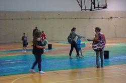
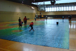
On October 13th, 2018 we rolled out the map at ASU's annual Earth and Space Exploration Day. Unfortunately, the remnants of Hurricane Sergio passed over Tempe that morning, dumping an amazing 3 inches of rain in only a few hours. But that wasn't enough to deter the hardcore space enthusiasts! We had over 200 people walk through the rain to reach us, often arriving soaking wet despite their umbrellas. Once inside the Physical Education West gym, they also avoid the many roof leaks to explore "Mars" with their families. Hopefully next year's ESE Day will be a little drier!

DSC04041
DSC04040
DSC04038
DSC04039
DSC04036
DSC04037
DSC04032
DSC04033

ABOUT US >

The 2001 Mars Odyssey spacecraft and the Thermal Emission Imaging System (THEMIS) have been acquiring infrared images of Mars for more than 16 years. The best-quality images from the mission have been compiled into a global mosaic at 100 m/pixel resolution and printed on a walkable basketball-court-sized vinyl mat to spread awareness and excitement about Mars exploration!

Homepage Background Image: Full-disk image of Mars with the Tharis volcanoes in the west and Valles Marineris in the east from the Mars Orbiter Mission (MOM) Mars Color Camera (MCC). Image courtesy of the Indian Space Research Organization (ISRO), the Indian Space Science Data Center (ISSDC) and Emily Lakdawalla.

bottom of page